3D Visualisation and Digital Documentation of the IIST Library from Terrestrial LiDAR scans
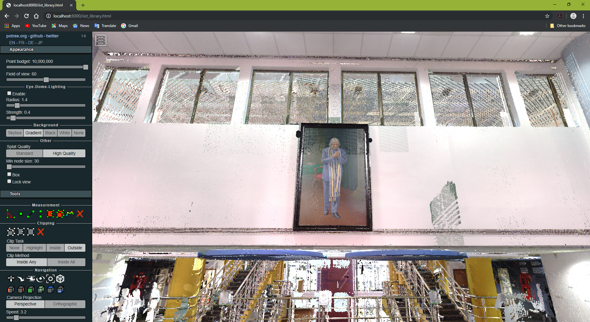
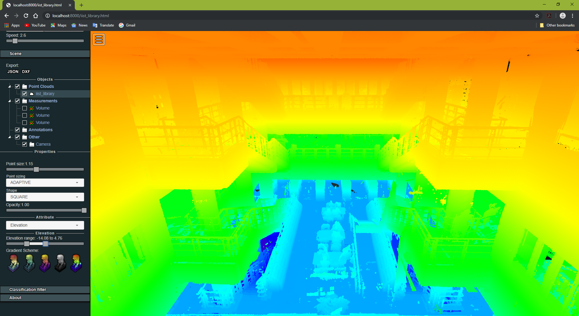
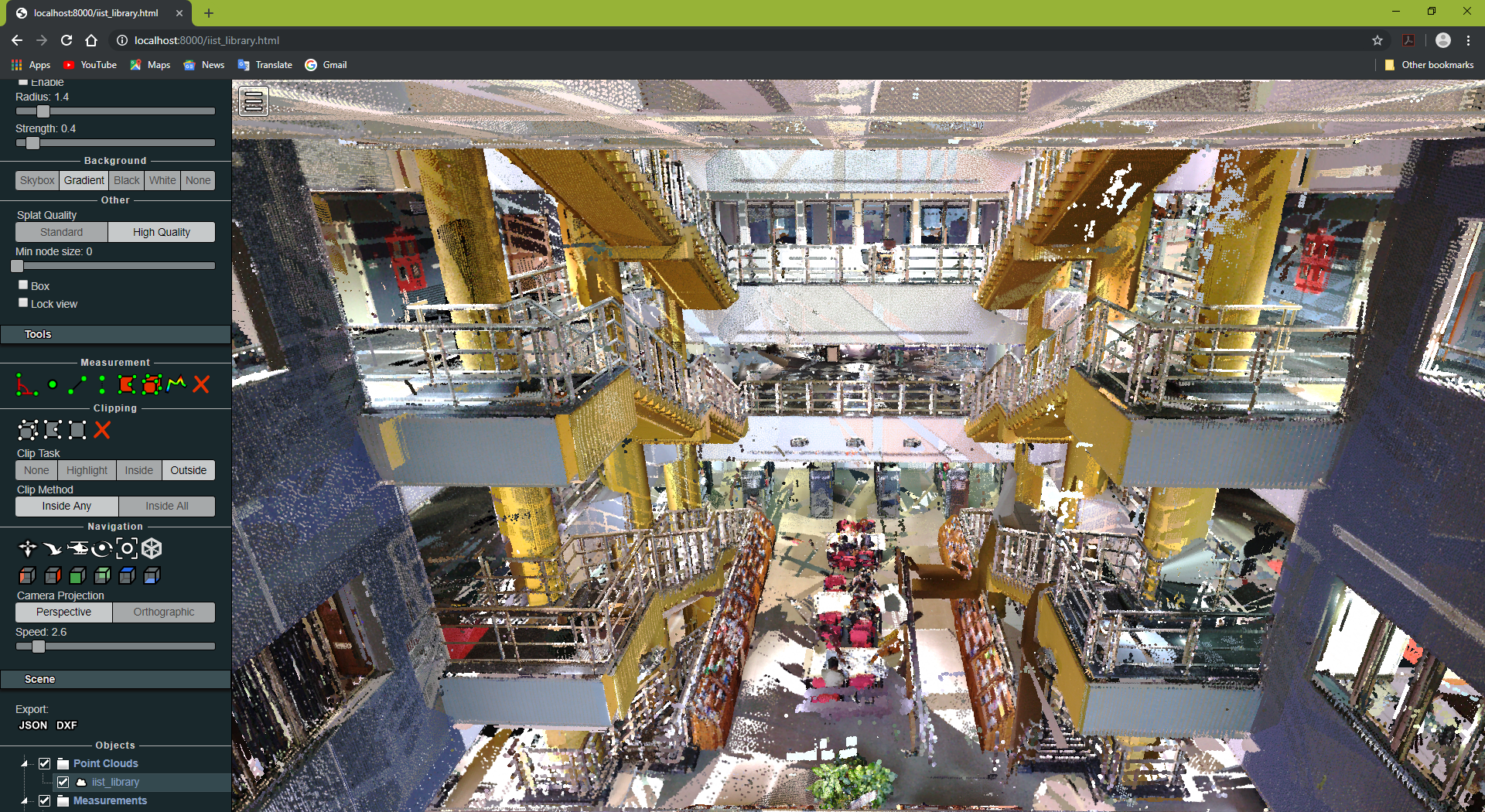
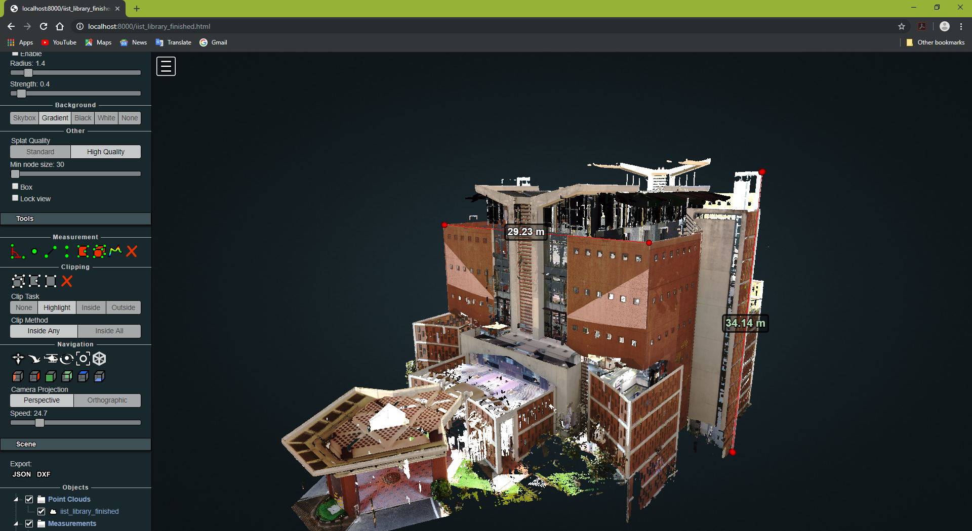
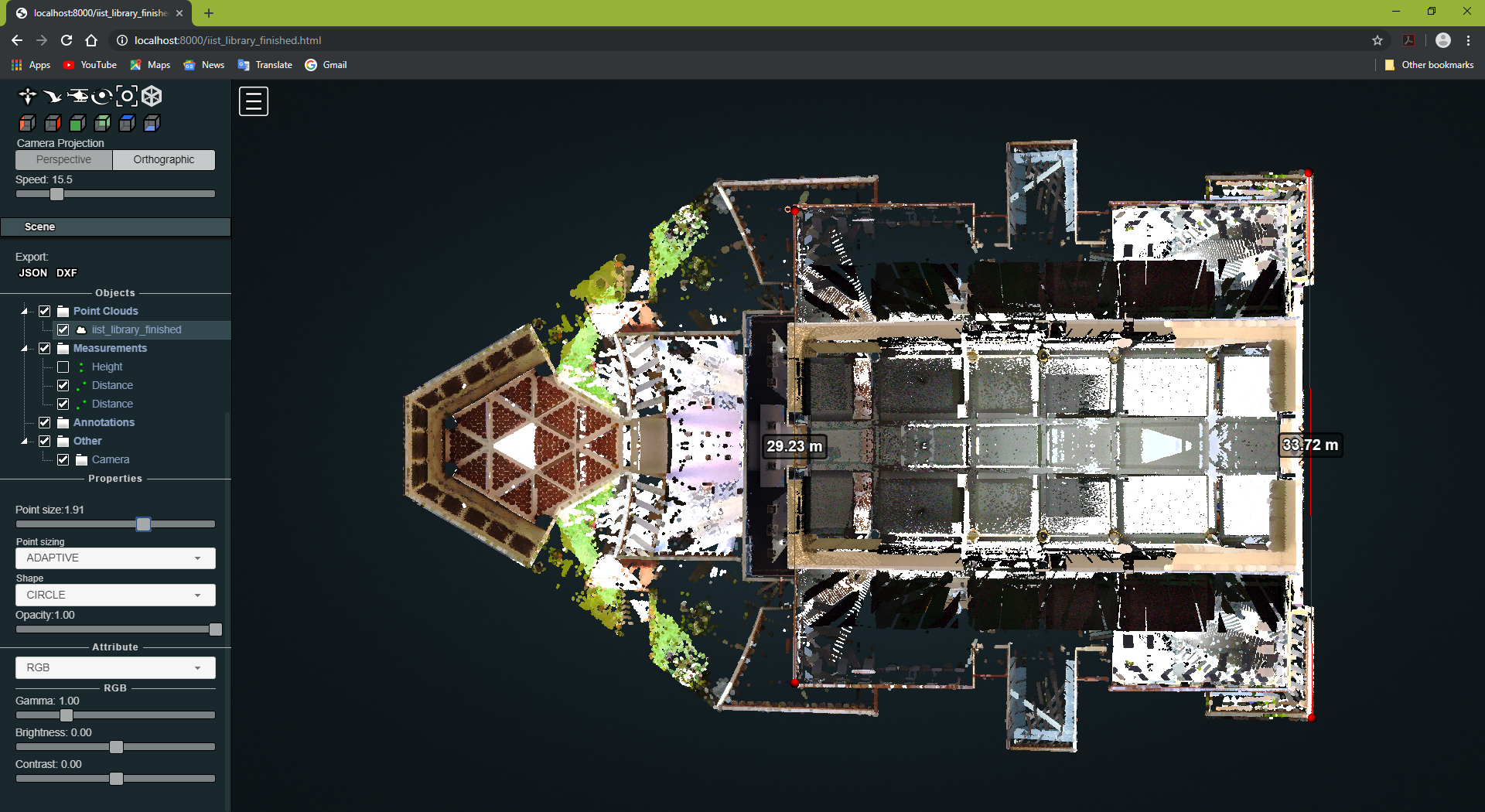
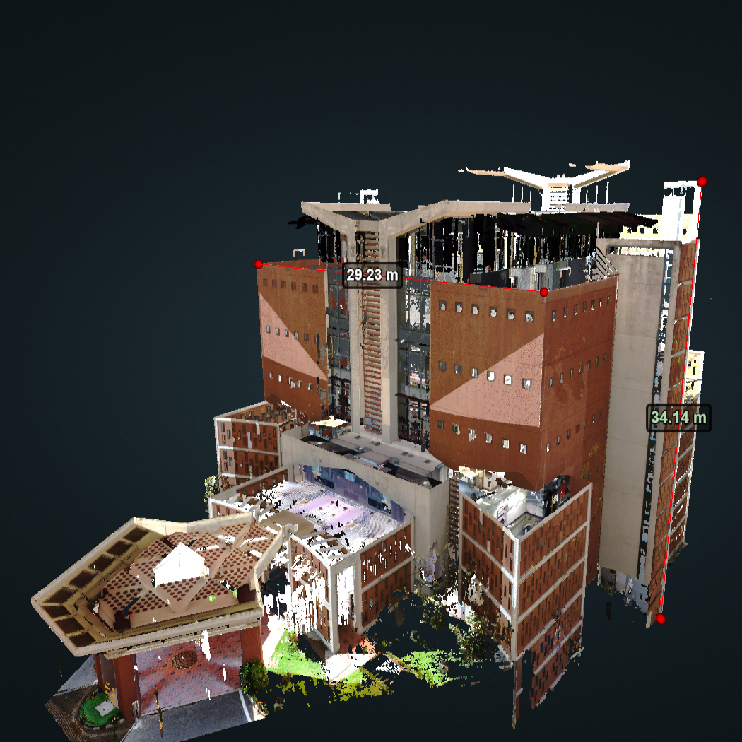
The primary objective of this project was to digitally scan, document and visualise the entirety of the IIST Library. The library was chosen as the object for documentation owing to it being a landmark structure of the IIST campus. In this study, the FARO Focus S350 terrestrial laser scanner was used to conduct the LiDAR surveys. After completion of the survey, the collected point cloud data was transferred to the Remote Sensing Lab for further processing.
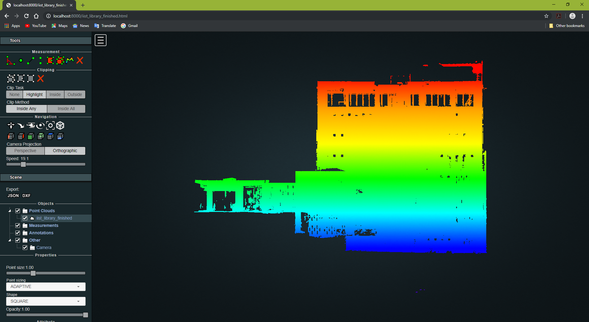
During registration of the individual scans, it was observed that indoor & outdoor surfaces of buildings offered plenty of easily-identifiable target points which allowed the scans to be registered manually without standard target objects. Upon further processing, the very large size of the point cloud proved to be a hindrance and hence, the point cloud was downsampled to a reasonable extent. The Potree WebGL based point cloud rendered was found to be well suited for the task of digital documentation and visualisation of large point clouds.